Drone Roof Inspection in Yuma, AZ
For an asset manager with a dozen roofs to review before a budget meeting, the drone is a way to buy the same record at a fraction of the schedule cost. A large flat roof in Yuma, AZ can take hours to walk, and in the late afternoon the surface can run too hot for a long walk anyway, since a flat membrane in a Yuma summer climbs well past the air temperature. A drone covers the same field in minutes, at the cooler hours of the day, and returns a high-resolution image set that shows ponding marks, discoloration, displaced flashing, debris in drains and equipment layout. It does not replace a hand probe of a seam, but it tells the crew where to spend its time on the roof, and it gives the owner a visual record that any lender or board member can understand.
Roof leaking now? Call 555-555-5555 for a site visit and estimate.
What does a drone find that a walk could miss?
A drone sees the whole roof at once, which lets it reveal patterns. A band of dark staining that runs toward a drain, a series of repair patches in a line across the field, a chalked strip along a south edge where the sun is strongest, or a cluster of debris against a parapet all become obvious from altitude. On a walk, each of those would be seen as an isolated detail. The drone is also valuable for sections the crew cannot safely reach, such as a fragile skylight area, a steep metal panel run or a roof next to a live loading area. It gives the manager a baseline image from which any change can be measured at the next visit, which is how a roof history becomes a trend and not a series of one-off snapshots. Over several years the same flight path, flown in the same season, shows how quickly chalking spreads, whether a ponded area is growing and whether repairs have held, all of which feed the capital plan with evidence instead of estimates.
Related Roofing Work
Other pages that cover parts of the same roof question.
Roof Capital Planning
Infrared Roof Moisture Survey
Commercial Roof Inspection
Yuma Palms and the I-8 Retail Corridor
South Yuma Airport and Industrial Area
San Luis
What can a drone not tell the owner?
A drone sees the surface, and it cannot feel it. It cannot probe a seam to see whether the weld has released, tap a surface to hear a blister, or tell dry insulation from wet beneath an intact membrane. Photographs taken in harsh midday sun can wash out fine cracks, and a membrane that looks sound from altitude can hide a lifted flashing at close range. For those reasons, we use the drone as a screening tool and a documentation tool, then follow it with a hands-on walk of every area it marks. Where moisture is the question, the method is an infrared survey, which the drone can carry out with a thermal camera at the right hour. The decision to repair or replace never rests on a drone image alone. A flagged area is only a question, and the answer comes from a person standing on the roof with a probe, a moisture meter and a camera.
How are flights planned near the airfield?
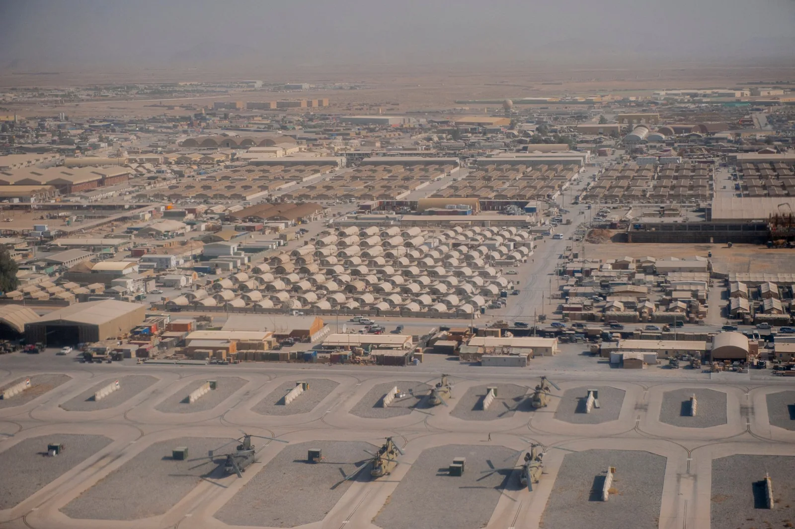
Yuma International Airport shares its airfield with Marine Corps Air Station Yuma, which operates four runways, and the field sits only a few miles south of downtown. Any commercial drone flight in controlled airspace needs authorization before launch, and flights near active runways need coordination with airport and military operations. We check airspace before every job, request authorization where required and schedule flights around training and arrivals. In practice, this matters most for roofs in the airport industrial area and nearby south Yuma properties. We tell the property manager at the quoting stage whether authorization may delay the flight, so the schedule includes that time and the inspection date is not a surprise. Because the shared airfield carries both military and civil traffic, flights may be limited to certain hours or altitudes, and we plan the route so the roof is covered within those limits. Flights stay clear of the runways and approach paths, and we hold the aircraft in view throughout, as the rules for small drone operations require.
Why does the time of day matter on a hot roof?
Image quality and thermal data both depend on the hour. Early morning light is low and even, which highlights ridges, seams and ponding marks. Midday sun flattens the roof and turns a white membrane into glare. For thermal imaging, the best readings come after sunset, when a roof that absorbed heat all day begins to release it, and wet insulation holds heat longer than dry insulation around it. In Yuma, where surface temperatures are high for most of the year, the thermal window opens soon after dark. We schedule flights accordingly, so the manager gets images at the time of day when they are most informative. Wind matters too: gusts that precede monsoon storms ground the drone, so summer flights are scheduled for calm hours and rescheduled when the weather turns.
What does the owner receive after the flight?
The owner receives a stitched overview of the roof, a set of detail images keyed to a plan, and a short list of areas flagged for hand inspection. Each image carries a date, a location and a note describing what it shows. If a thermal flight was flown, the thermal images are paired with visible-light images of the same area so the reader can match a warm or cool patch to its place on the roof. The images go into the roof file alongside the hands-on inspection and the condition report, and they are kept for comparison at the next visit. For a portfolio, we can image several roofs on the same day, which gives the manager a consistent basis for ranking them.
Questions About Drone Roof Inspection
Is a drone inspection accepted by insurers and lenders?
Dated images with a roof plan are widely used in claims and due diligence, and we pair them with a hands-on walk of flagged areas. Acceptance is the reviewer's decision, but a complete record is hard to dispute.
Can the drone fly over an occupied building?
Yes, over the roof, with the property manager informed in advance. We avoid flying over people, keep clear of open parking and entrances, and follow the rules for operations near the public.
What if the weather stops the flight?
We reschedule. Gusts, dust and storms ground the drone, and we move the flight to the next calm window.
How much sooner can a drone survey finish than a walk?
On a large roof, the flight itself takes minutes where a walk takes hours, though the report time is similar. The saving is in site time and in knowing where to send the crew.
Do you need the roof plan beforehand?
A plan helps, but is not required. If none exists, we build one from the drone's stitched image, which becomes the base drawing for future inspections.
Where does a drone pay for itself in Yuma?
The payoff is greatest where roofs are broad, numerous or awkward to reach. The retail roofs at Yuma Palms, with Best Buy, Ross and Marshalls among its tenants, can be imaged in a short visit before any crew goes up. Properties in the airport and Highway 195 industrial area, where Panattoni is putting up a mega site, suit the method wherever the buildings are broad. Multi-building owners with sites in San Luis and Somerton can survey a portfolio quickly before setting capital priorities. A drone is also a sensible first look after a storm, when walking an unknown roof could be unsafe. In each case, the drone shortens the path to a decision.
Send the addresses and the access notes
Send the building addresses, roof sizes and any airspace or access limits you know of, and we will plan the flight window, check authorization and return a dated image set. A hand inspection of flagged areas follows.
Call 555-555-5555 or email [email protected].